In March, the IQ Center took to the skies to gather data for the Geology department.
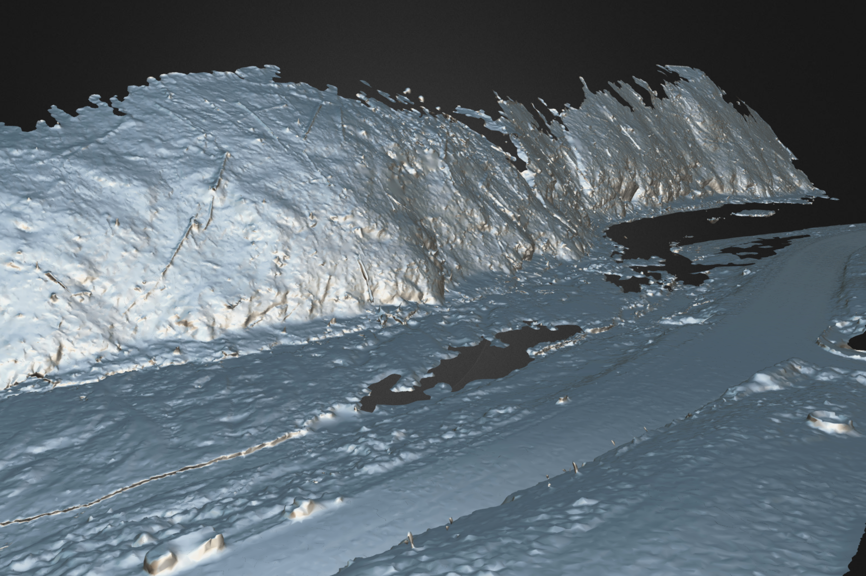
Knowing that some students might not able to attend lab in person, Professor of Geology Chris Connors got some help from the IQ Center to create a photogrammetry model of the rocky outcroppings he was interested in, so students could view the formations from anywhere.

Photogrammetry can be a tricky process. Essentially, the goal is to visually identify common points between multiple photos, and using sophisticated software, stitch the photos together into a 3D model that lets us zoom, rotate, and examine areas of interest.

There’s a lot to consider when shooting for a photogrammetry project.
For one, the shoots can take several hours – enough time for the sun to travel a considerable distance in the sky, which changes light levels, shadow positions, and reflections. This means a cloudy day is ideal, but it can be difficult to plan trips around weather.


Another consideration is how the pictures should be taken. Due to the scale and location of the subject, this project necessitated using the IQ Center’s drone.
This means an extra set of challenges: safe takeoff, flight, and landing, watching battery life, and the multitasking involved with both piloting and taking pictures is a lot to focus on.
The tradeoff is that previously inaccessible shots are now within reach!

View the final photogrammetry model.
Get a behind-the-scenes look at how the IQ Center operates their drone on their Instagram: @wluiqcenter
Want to incorporate photogrammetry into your course? Contact Dave Pfaff at 540.458.8044, email dpfaff [at] wlu [dot] edu or stop by the IQ Center!